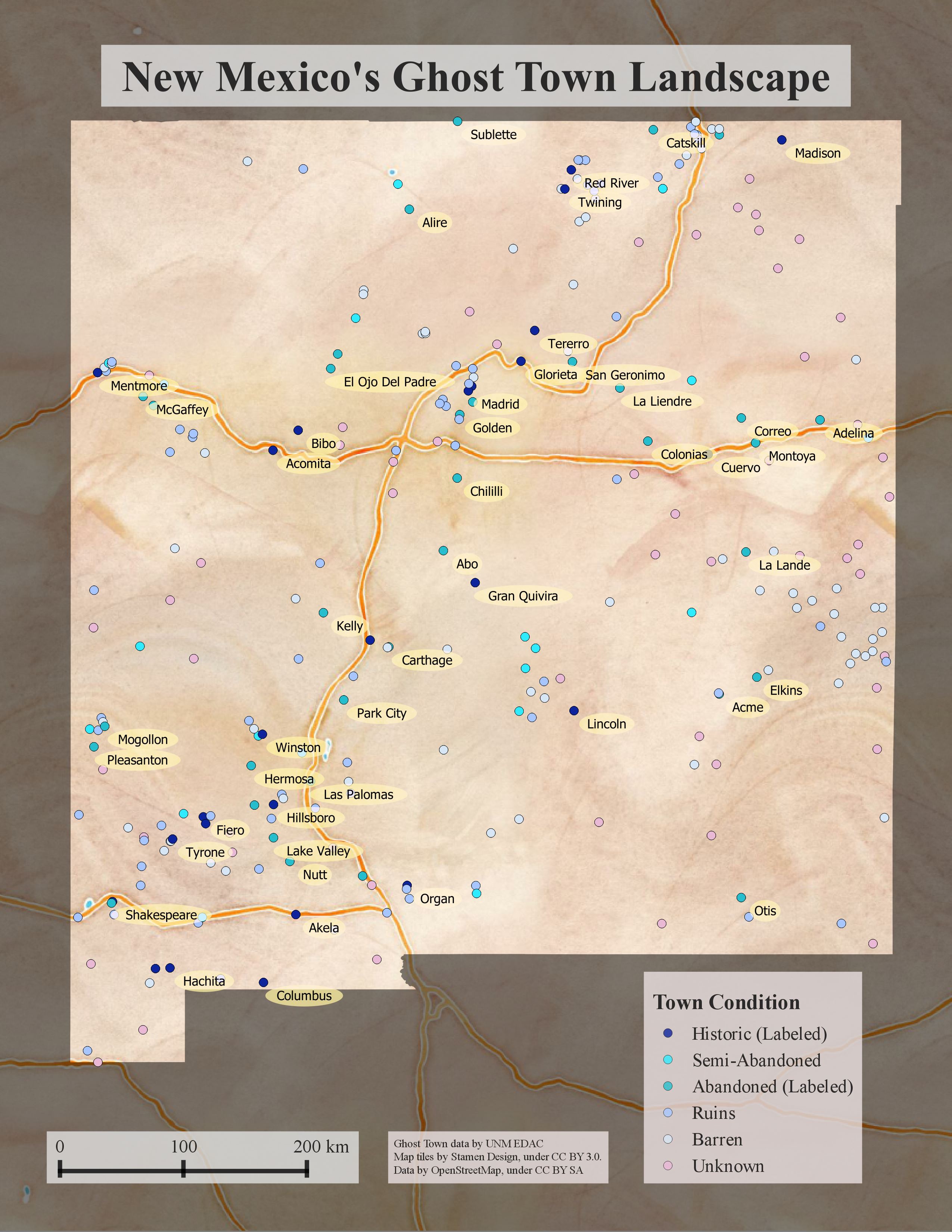
Using Leaflet JS to map mines in and around New Mexico

Mines in and around New Mexico (Interactive Map) The recent mine spill on the Animas River has resulted in an increased interest in the locations of current and past mines. We set out to create an interactive Webmap of the mines in the USGS Mineral Resources Data System (MRDS) to… Continue reading

Up in Flames: Creating Defensible Spaces to Reduce Wildfire Damage

upinflames_sciencefair_poster

Urban development continues pushing farther out of cities and into wilderness areas for both primary and secondary residences. As a result, the amount of homes damaged due to accidental and natural forest fires continues to increase drastically. Along with this, there have been recent measurable changes in New Mexico’s climate.… Continue reading

New Mexico Public Land Survey System (PLSS) Finder

Township with Section Numbers

Have you had problems locating a particular section or quarter section? Do you want to know the Township, Range and Section number for your house? If so, the New Mexico PLSS finder application will help you. It lets you enter the Township and Section number and then identifies your area… Continue reading

Blackdom: The First All-Black Settlement in New Mexico – A Story Map

Blackdom

The Blackdom Story Map highlights the history of a little known event  in New Mexico History. The first all-black settlement in New Mexico was incorporated in 1903 and occupied until the mid-1920s by up to 300 people. Blackdom had a school, post office and several churches during this time. This… Continue reading

Impacts of September 2013 Flooding in New Mexico – A Story Map

Impacts of September 2013 Flooding in New Mexico story map focuses on the impacts of the rain event that took place between September 10 and 18, 2013 that caused extensive flooding and record stream flows across the State resulting in two Presidential Disaster Declarations totaling more than $18 million. This… Continue reading