

Guest Post by Steve Walker, GIS Coordinator with the New Mexico Water Resources Research Institute | From the April 2015 issue of the NM WRRI New Mexico Water eNews Newsletter
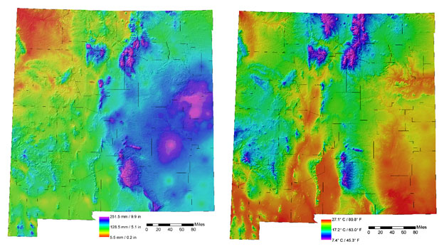
New Mexico precipitation and temperature data from PRISM
Before the advent of reliable geographic information systems (GIS), official, 30-year average, hand-drawn climate maps for the U.S. were produced by expert climatologists. Weather station observations were plotted on maps and contours of temperature and precipitation were subjectively interpolated between the observations. The process was tedious and time-consuming. Most official precipitation maps for many states were up to 30 years out of date. Statistical algorithms were available to interpolate values between point observations, but they produced unrealistic maps. They could not ‘understand’ how physiographic features, such as mountains and coastlines, affected climate patterns.
In 1991, a design team led by Chris Daly, a Ph.D. student at Oregon State University, wrote an algorithm program that mimicked the thought processes that expert climatologists use to create climate maps. Elevation was known to be one of the main contributors to precipitation patterns. On a pixel by pixel basis, a local statistical relationship, called a regression function, was developed to predict precipitation at the elevation of each pixel. At first, the relationship between precipitation and elevation did not predict accurately across all landscapes, because of rain shadows. Areas on different sides of mountains have very different precipitation values, even at the same elevation. Afterward, the algorithm was adjusted to divide terrain into slope facings (N, NE, E, etc.) and observations were grouped according to those facings. The system was eventually named PRISM (Parameter-elevation Regressions on Independent Slopes Model).
Researchers at NM WRRI plan to use PRISM data to determine up-to-date precipitation and temperature values for all water planning regions and counties in New Mexico and all catch basins entering and within the state. These values will serve as one of the primary components of the comprehensive water budget for the New Mexico Statewide Water Assessment.
PRISM data is available for New Mexico from the RGIS Geospatial Clearinghouse within the climate theme.