Twitter YouTube
NM RGIS
 
Skip to content
  • About
  • Get Data
  • FAQ
  • GIS in Practice
  • Resources
  • Donate

Tag: Meth Labs

Clandestine Meth Labs in New Mexico

  By sandeep September 14, 2015 January 15, 2016 GIS In Practice
methlabs

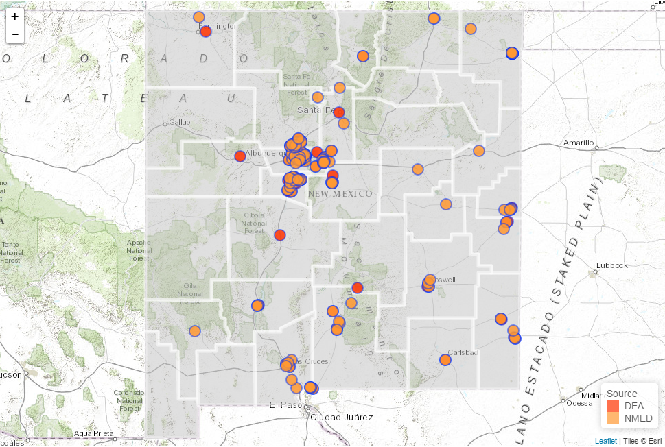
Clandestine Meth Labs in New Mexico (Interactive Map) In the period from 2004 till 2013 the Drug Enforcement Agency (DEA) and the New Mexico Environmental Department (NMED) collected data on the location of Clandestine Meth Labs located in the state. This data was displayed in a table on the websites … Continue reading

Tagged   DEA, Meth Labs
  • RGIS News

    • RGIS Funding
    • New Mexico Lidar Data Status Map
    • RGIS – New Data Portal
    • DEM Analysis – The many uses and derivatives of a Digital Elevation Model
    • Clandestine Meth Labs in New Mexico
    • Using Leaflet JS to map mines in and around New Mexico
    • Implementing Web AppBuilder for ArcGIS at the City of Rio Rancho
    • Updating Archeological Site Field Data Collection Methods to Twenty First Century
    • Up in Flames: Creating Defensible Spaces to Reduce Wildfire Damage
    • NM WRRI Acquires PRISM Climate Data
  • Tag Cloud

    Animas River Spill ArcGIS archeology Baseline Blackdom Cadastral City of RioRancho Climate data collection DEA Defensible Spaces Drought ESRI Flood geojson Ghost Town GIS Tips Groundwater Harvey House Historic Imagery JavaScript LeafletJS Meth Labs Mines Model Builder NAIP New Mexico NMTRD NM WRRI PLSS Principal Meridian PRISM QGIS Reservoir RGIS Section SNOTEL Snow cover Story Map Township USGS Water Web AppBuilder Wildfire
  • Archives

  • Earth Data Analysis Center/RGIS Support Fund

  • Tweets by @nmrgis
All content Copyright © 2015 by the Earth Data Analysis Center, University of New Mexico
Phone: (505) 277-3622, Email: clearinghouse@edac.unm.edu
Powered by Parabola & WordPress.
Twitter YouTube