

Category: GIS In Practice
New Mexico Lidar Data Status Map
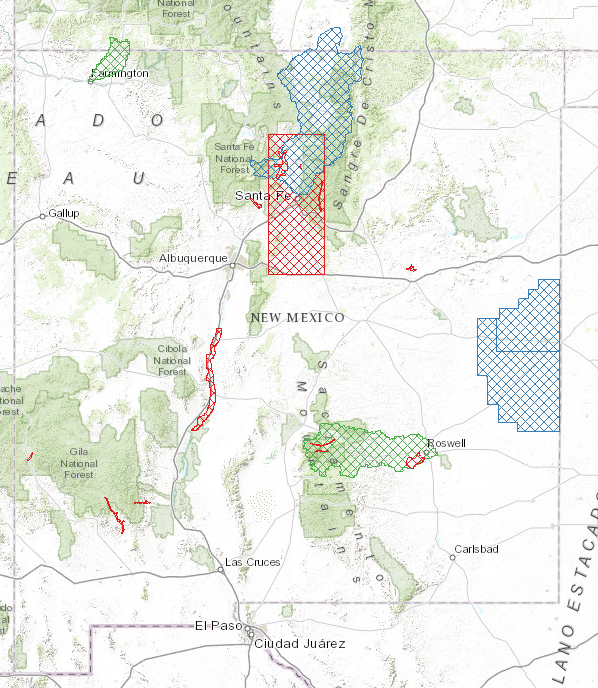
New Mexico Lidar Status (Interactive Map) Increasingly, New Mexico’s key geospatial data needs must be met with high-quality, high-resolution, and current elevation data. Enhanced elevation data are essential to a broad and cross-cutting range of applications, analyses and evaluations, and established programs such as emergency preparedness, resource management, natural hazard… Continue reading
RGIS – New Data Portal
The New Mexico Resource Geographic Information System (RGIS) has launched a New Data Portal (http://rgis-data.unm.edu/) for New Mexico GIS resources. The new data portal has an improved user interface to enhance user experience. The portal is in Beta stage and we are working to migrate all of the thousands of… Continue reading
DEM Analysis – The many uses and derivatives of a Digital Elevation Model

Digital Elevation Models (DEMs) are raster files with elevation data for each raster cell. DEMs are popular for calculations, manipulations and further analysis of an area, and more specifically analysis based on the elevation. ArcGIS has several built-in functions that are very easy to use and will turn the DEM… Continue reading
Clandestine Meth Labs in New Mexico
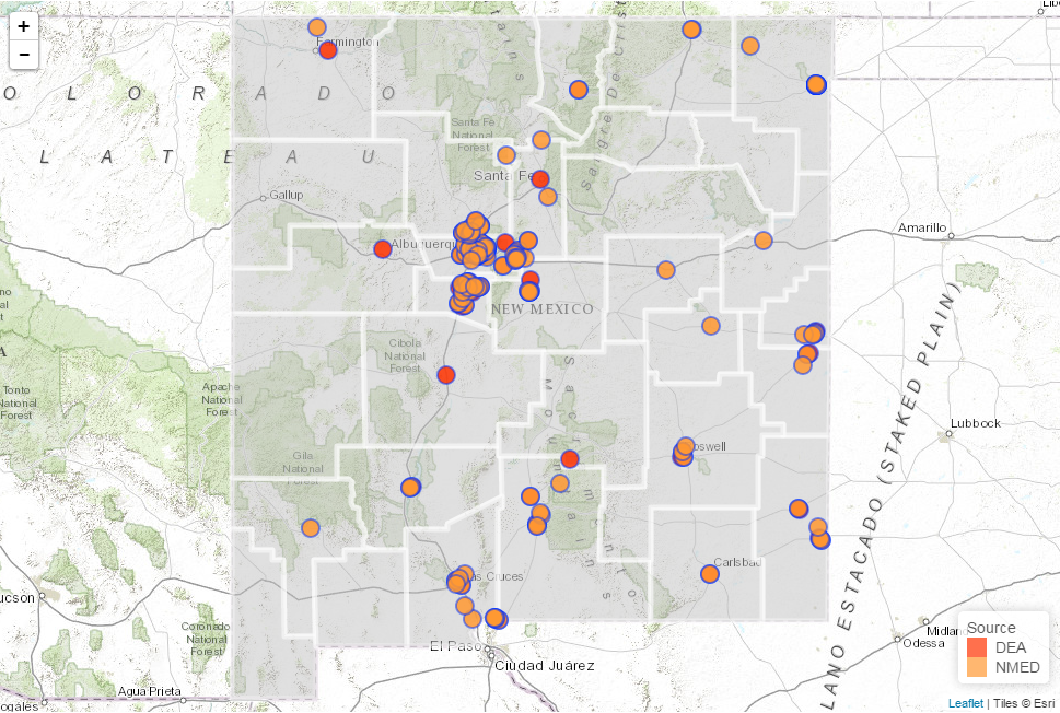
Clandestine Meth Labs in New Mexico (Interactive Map) In the period from 2004 till 2013 the Drug Enforcement Agency (DEA) and the New Mexico Environmental Department (NMED) collected data on the location of Clandestine Meth Labs located in the state. This data was displayed in a table on the websites… Continue reading
Using Leaflet JS to map mines in and around New Mexico
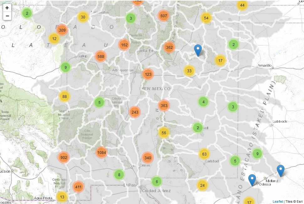
Mines in and around New Mexico (Interactive Map) The recent mine spill on the Animas River has resulted in an increased interest in the locations of current and past mines. We set out to create an interactive Webmap of the mines in the USGS Mineral Resources Data System (MRDS) to… Continue reading
Implementing Web AppBuilder for ArcGIS at the City of Rio Rancho
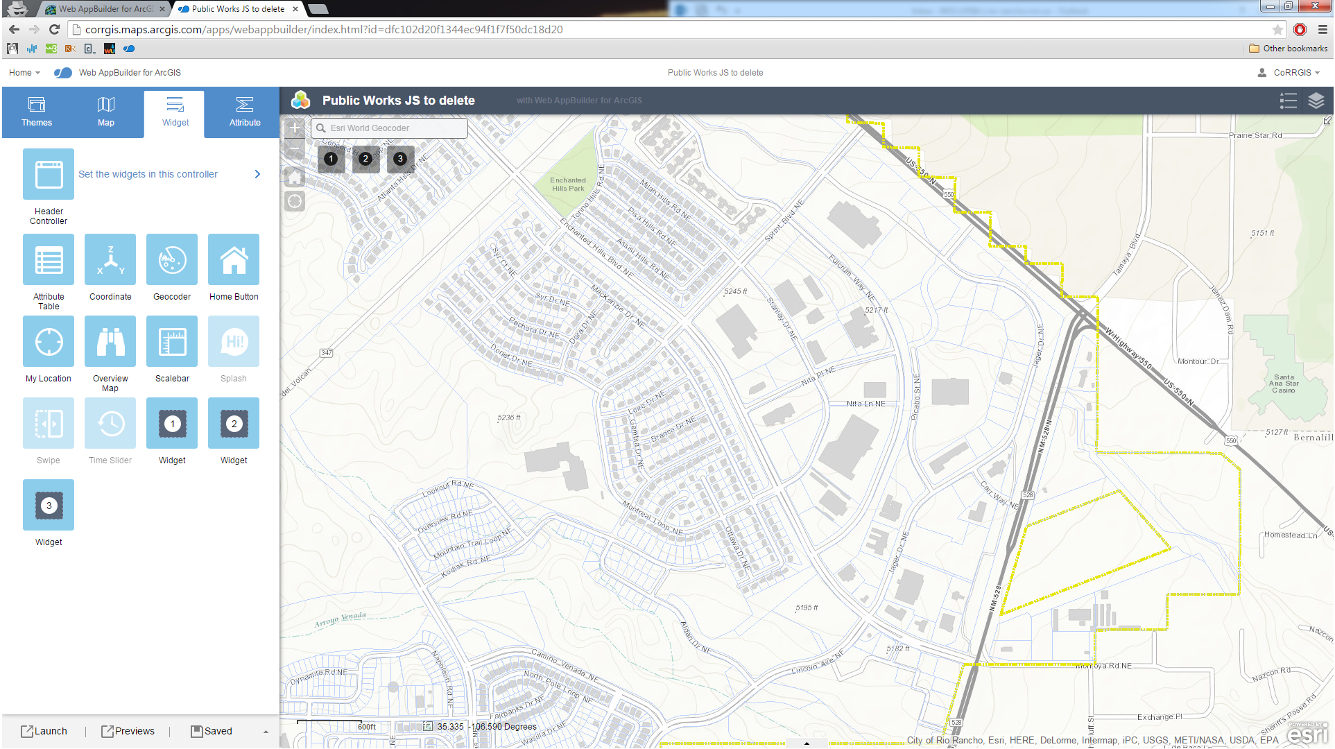
In the summer of 2014 the City of Rio Rancho’s GIS section began beta testing the ArcGIS Web Application builder. The builder creates a simple foundation for the deployment of HTML/JavaScript applications that can be hosted either by ESRI (via ArcGIS Online) or on your local webserver. The City had… Continue reading
Updating Archeological Site Field Data Collection Methods to Twenty First Century
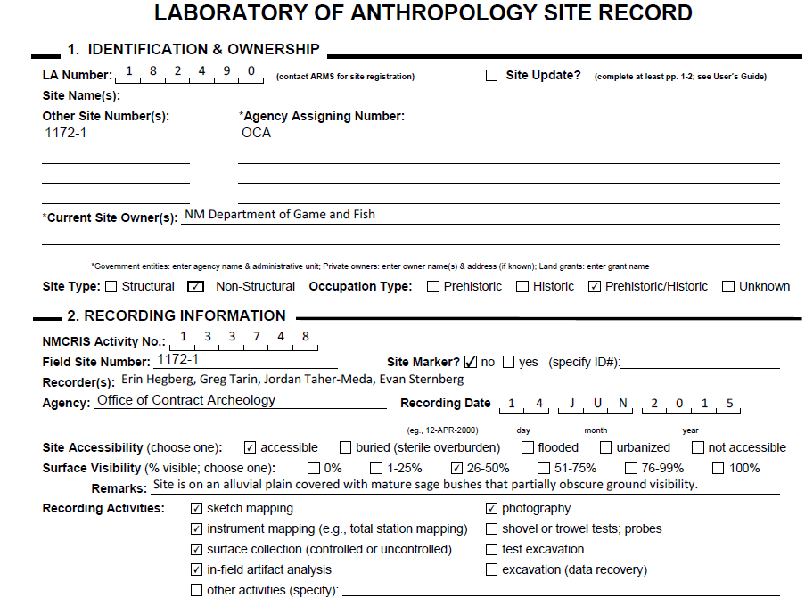
In March of 2015, the Office of Contract Archeology (OCA) at the University of New Mexico began field testing various digital approaches to recording archeological site information. One critical piece of information for any archaeologist working in New Mexico is the Laboratory of Anthropology Site Record, simply called the LA… Continue reading
Up in Flames: Creating Defensible Spaces to Reduce Wildfire Damage
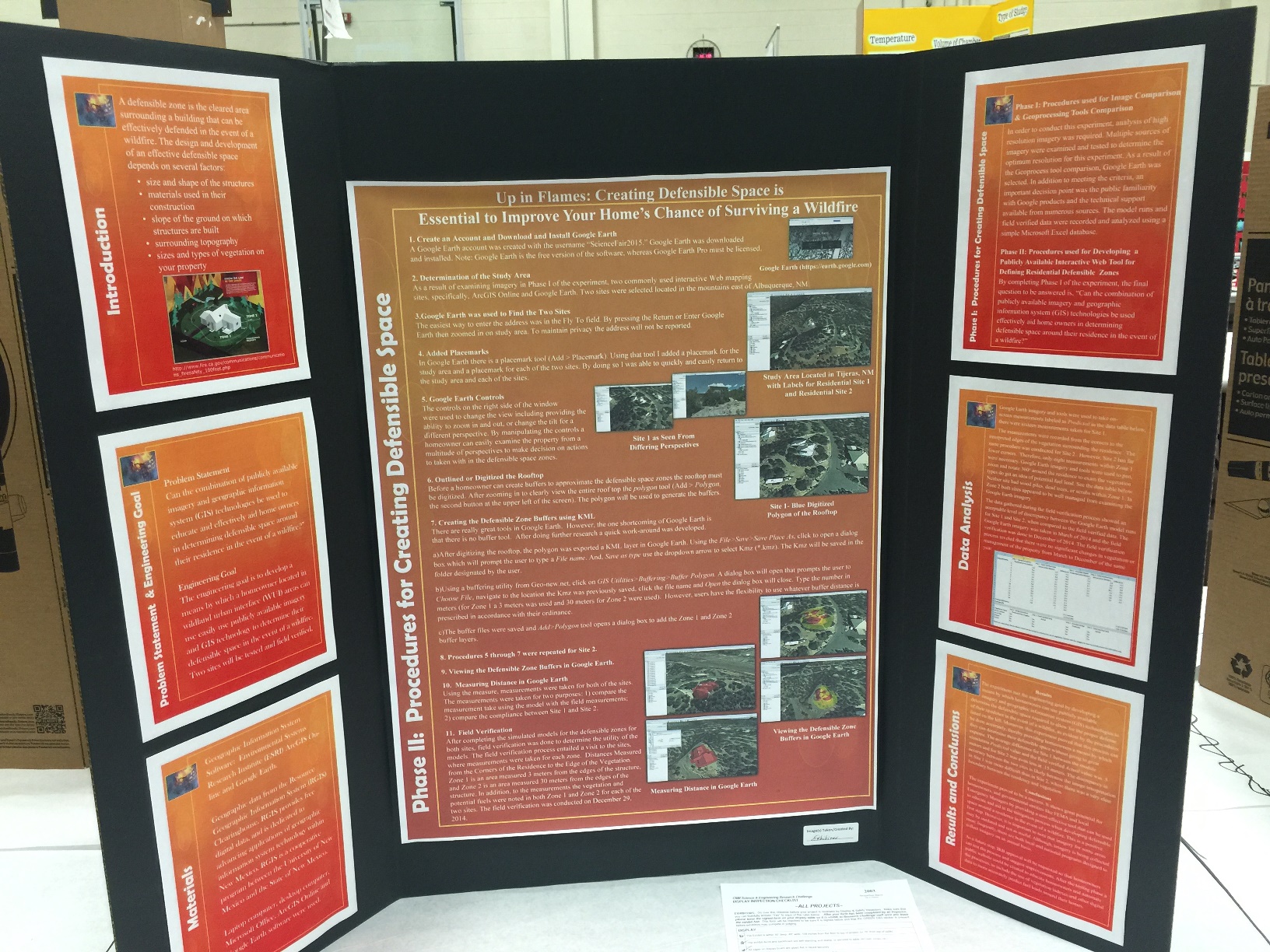
Urban development continues pushing farther out of cities and into wilderness areas for both primary and secondary residences. As a result, the amount of homes damaged due to accidental and natural forest fires continues to increase drastically. Along with this, there have been recent measurable changes in New Mexico’s climate.… Continue reading
NM WRRI Acquires PRISM Climate Data
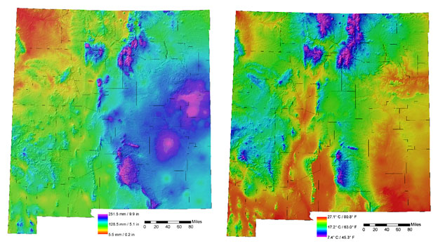
Guest Post by Steve Walker, GIS Coordinator with the New Mexico Water Resources Research Institute | From the April 2015 issue of the NM WRRI New Mexico Water eNews Newsletter Before the advent of reliable geographic information systems (GIS), official, 30-year average, hand-drawn climate maps for the U.S. were produced… Continue reading