


The Big I, Albuquerque, New Mexico
New Mexico Topographic Map
Albuquerque, New Mexico - 1964
Latir Peak, Carson National Forest, New Mexico
Fort Wingate, New Mexico


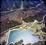 |
Image Archive Program: The Image Archive Program maintained by the Earth Data Analysis Center at the University of New Mexico hosts the largest collection of historical aerial photography data for New Mexico and the US Southwest. The collection also includes space shuttle imagery, satellite imagery, topographic maps, and digital data. |