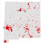
Changes in Snow Cover and Snow Water Equivalence in the Southwest

In February 2014, Earth Data Analysis Center received a request from the U.S. Senator Martin Heinrich’s office to determine the shrinking state of snow-pack in New Mexico. Our Remote Sensing Specialist performed data analysis using the satellite image data obtained from the National Operational Hydrologic Remote Sensing Center (NOHRSC) at… Continue reading

Impacts of September 2013 Flooding in New Mexico – A Story Map

Impacts of September 2013 Flooding in New Mexico story map focuses on the impacts of the rain event that took place between September 10 and 18, 2013 that caused extensive flooding and record stream flows across the State resulting in two Presidential Disaster Declarations totaling more than $18 million. This… Continue reading