

The past three years have seen over 648,000 acres of land burned in New Mexico due to wildfire. Many of the RGIS data sets can be used to assess the effect of wildfire on the landscape of New Mexico. RGIS has New Mexico Fire Burn Severity data from 1985-2010 in our Wildfire themes and pre- and post-fire digital imagery is available for the forests around many of the large burn scars.
This map shows the wildfires in New Mexico from 1984-2013.

Here are some examples of the Pre- and Post-fire imagey from the Little Bear Fire near Ruidoso, New Mexico in 2012.
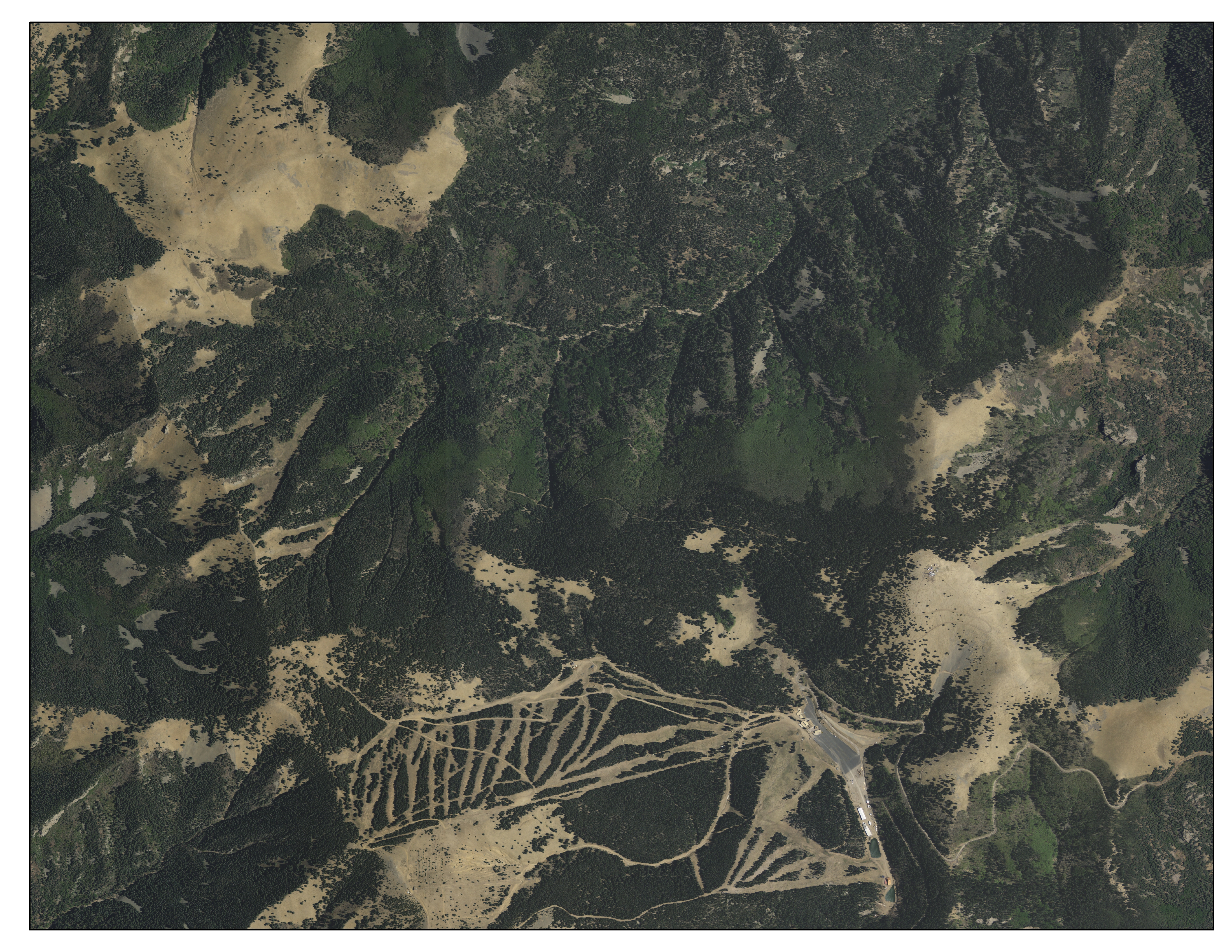 Ski Apache, Ruidoso, New Mexico – 2011 Ski Apache, Ruidoso, New Mexico – 2011 |
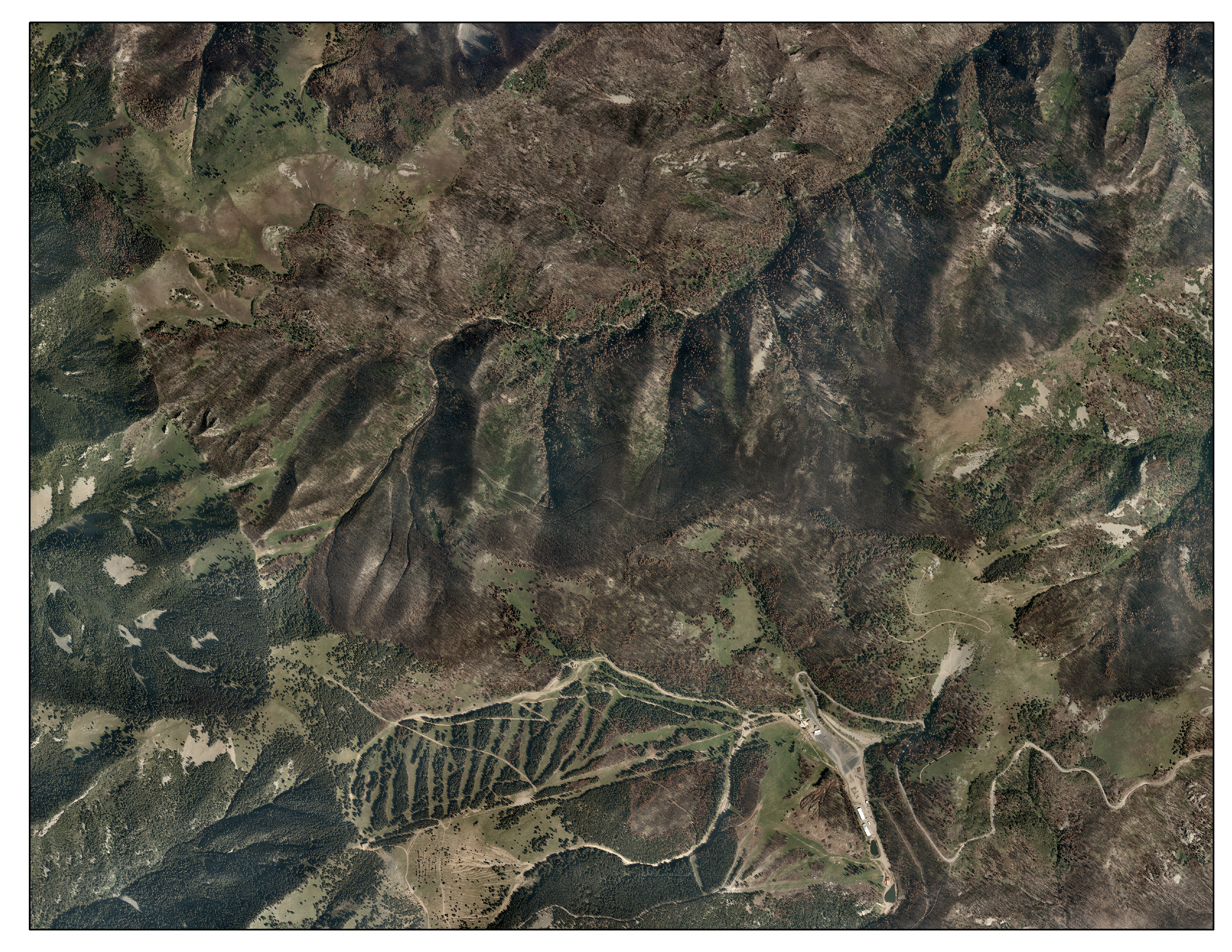 Ski Apache, Ruidoso, New Mexico – 2011 Ski Apache, Ruidoso, New Mexico – 2011 |
These are examples of burn severity data from some of the recent large wildfires.
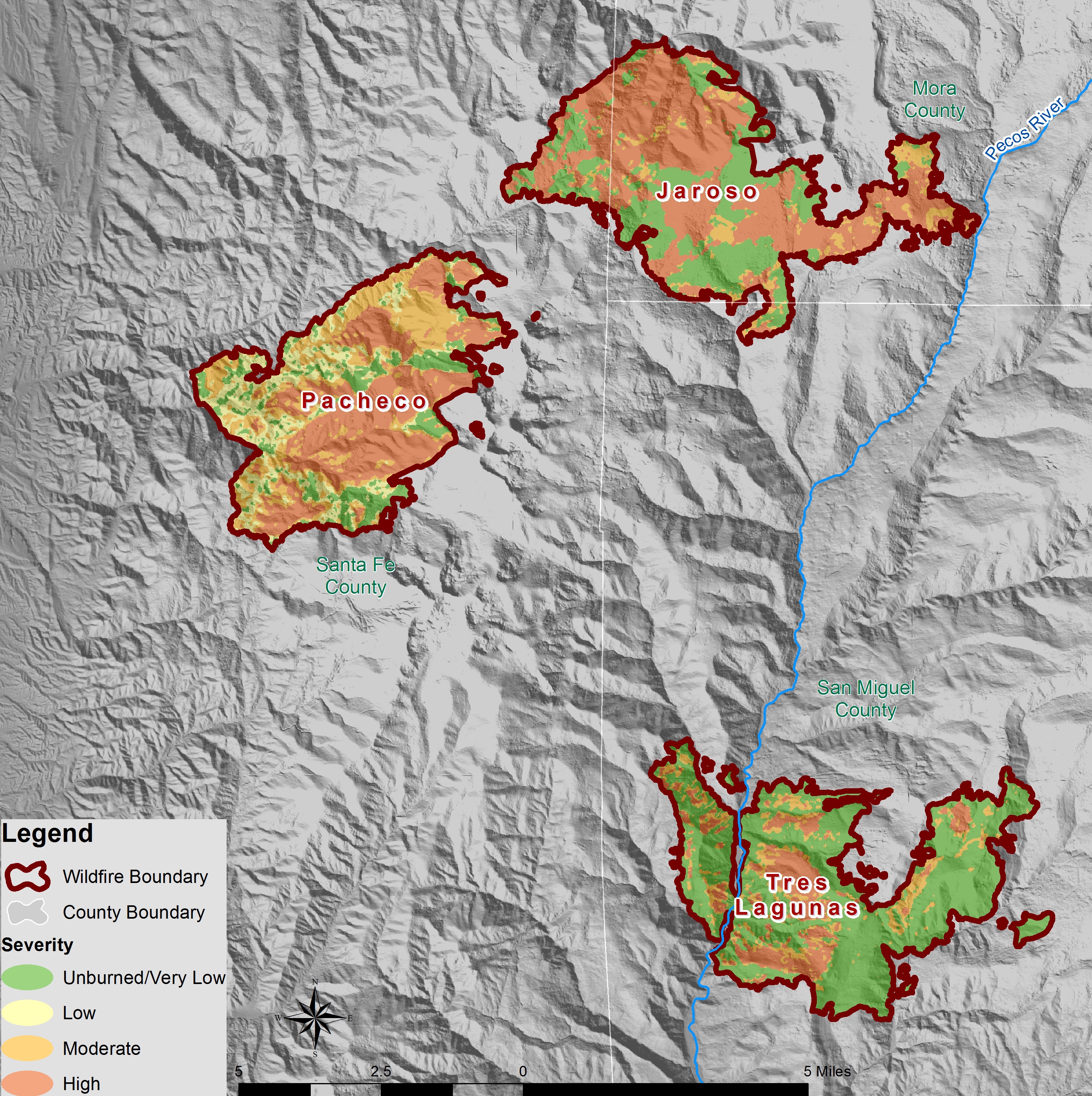 Burn Severity – Pecos Burn Severity – Pecos |
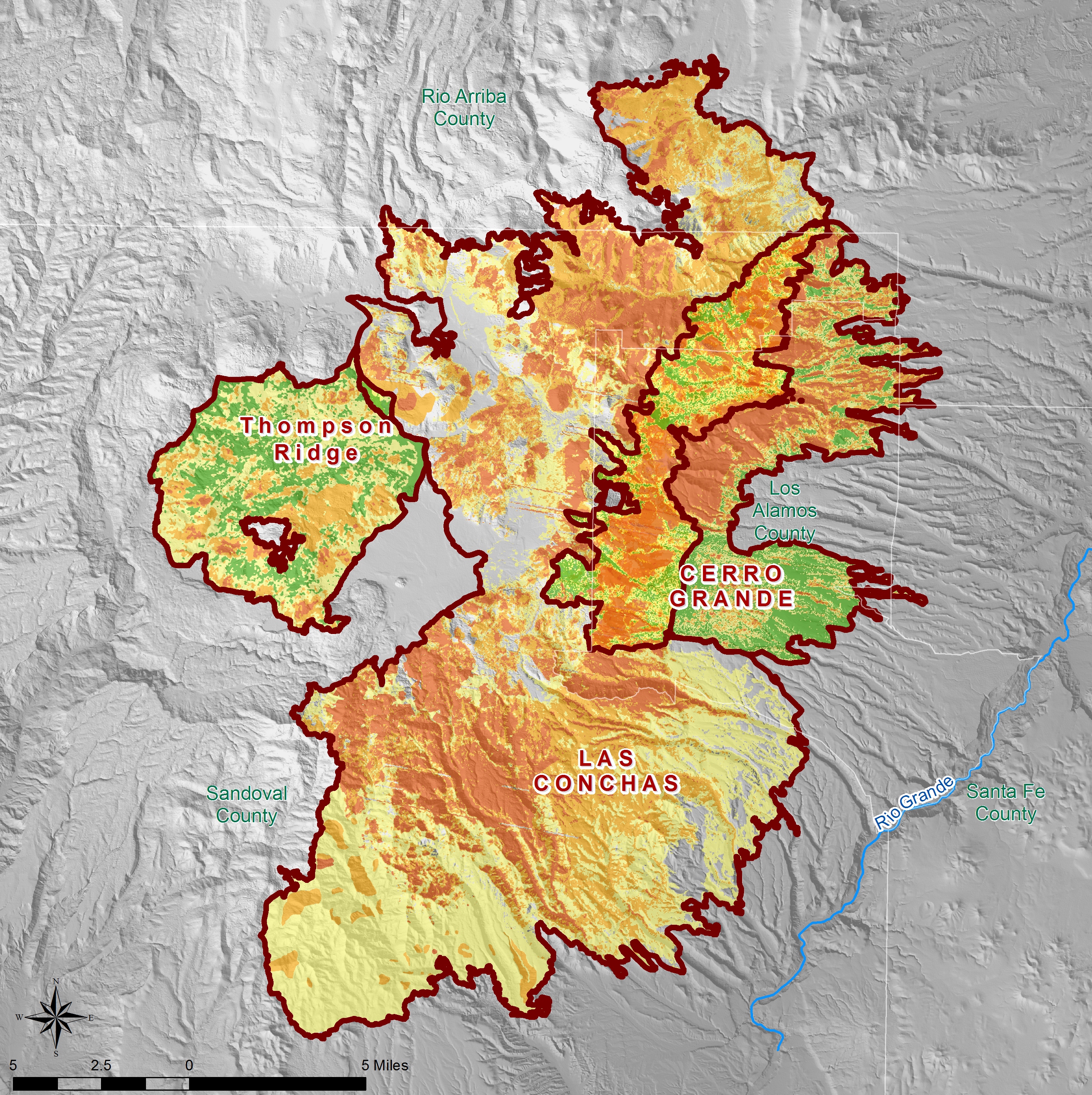 Burn Severity – Jemez Burn Severity – Jemez |
 Burn Severity – Whitewater Baldy Burn Severity – Whitewater Baldy |