As per NOAA National Climatic Data Center (NCDC) National Drought Overview for 2014, the United States experienced a significant recovery from the major 2012 drought on a national scale during 2013. The drought conditions returned in early 2014 with recovery in later year, contributing to the overall decrease in drought severity since December 2011. 2010 was a relatively normal moisture year in New Mexico; the dry spell began in October 2010 for the Southwest and Southern Plains (centered in Texas).
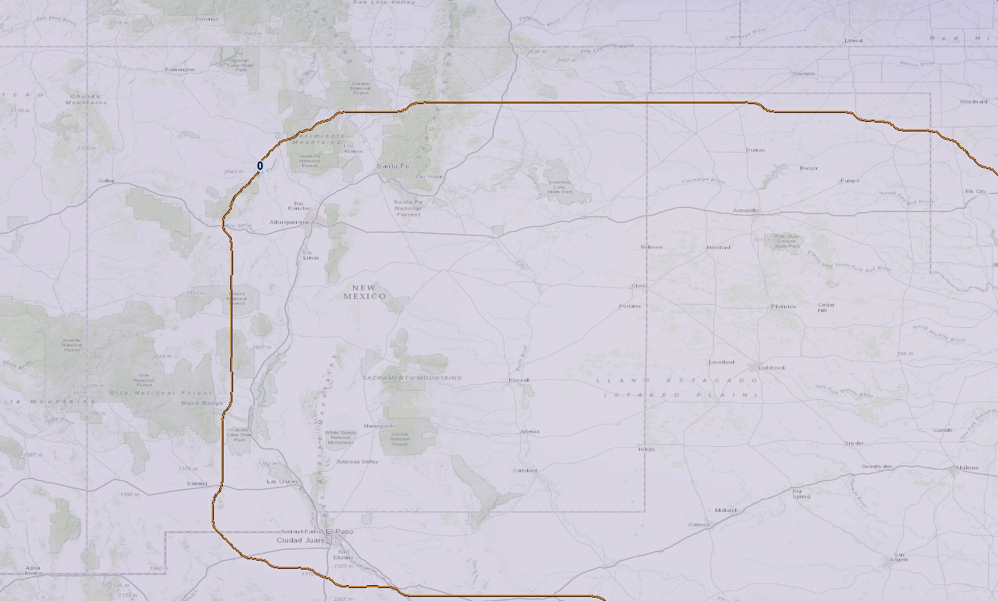
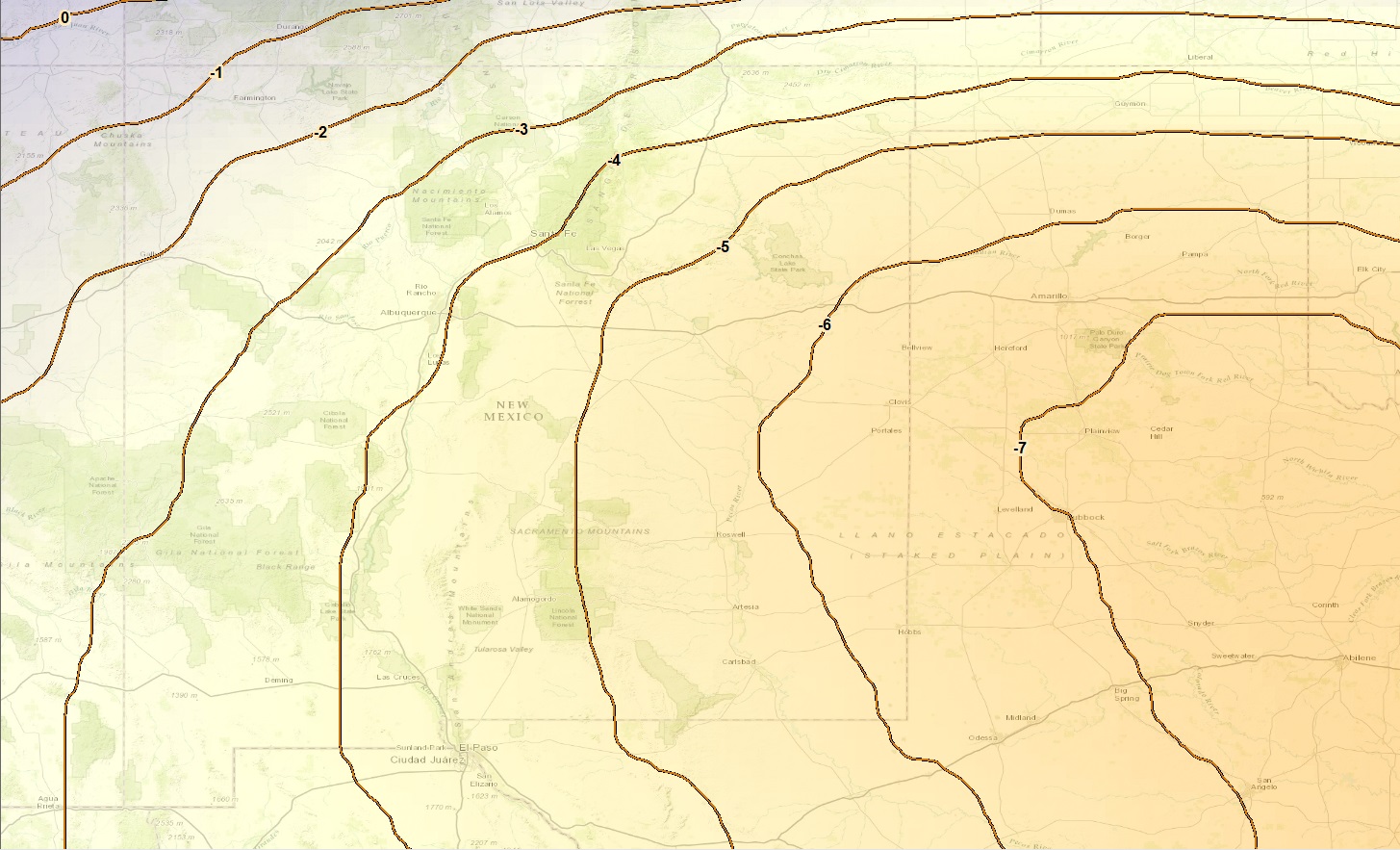
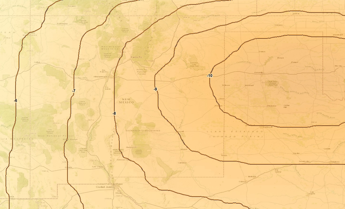
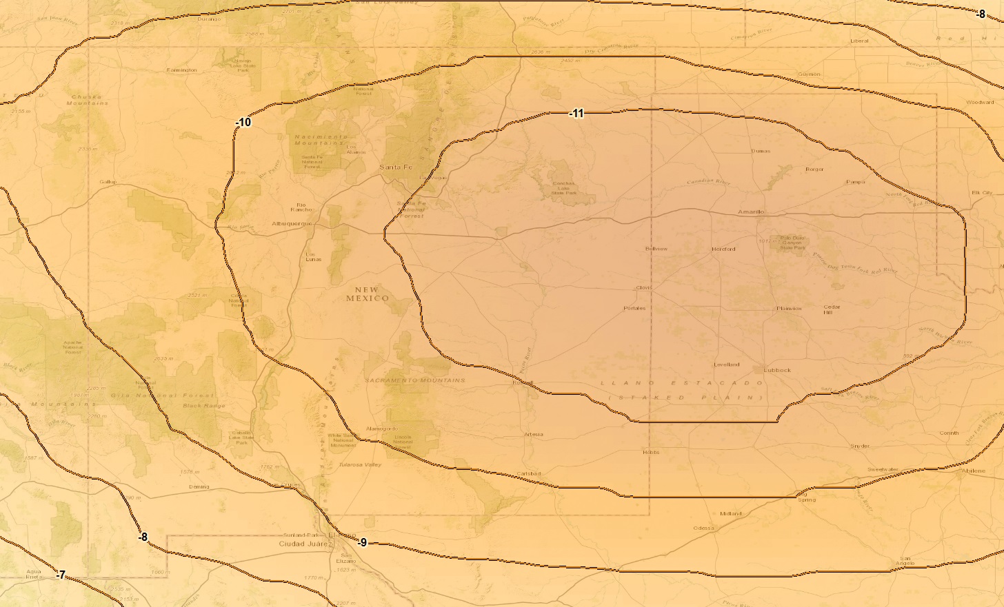
The images below show the progression of the multi-year drought from 2010 – 2013 for south eastern New Mexico in the High Plains Aquifer. These images are developed based on the data from NASA’s Gravity Recovery and Climate Experiment (GRACE) mission, which shows the sum of ground water changes for each year. Darker coloration represents increasing conditions of drought in those areas, and the contours show the loss in groundwater levels (in feet). Click to view larger image.
NASA’s GRACE is a twin satellite mission launched in 2002 to provide a high spatial resolution mean gravity field map of Earth. GRACE maps the Earth’s gravity field by making accurate measurements of the distance between the two satellites, using GPS and a microwave ranging system.
One of the principal changes to the gravity field is due to changes in the ground water depth. To identify these changes GRACE mission provides water thickness equivalent images on a monthly basis.
References:
1. NOAA National Climatic Data Center (NCDC) National Drought Overview for 2014
2. NOAA National Climatic Data Center (NCDC) National Drought Overview for 2011


