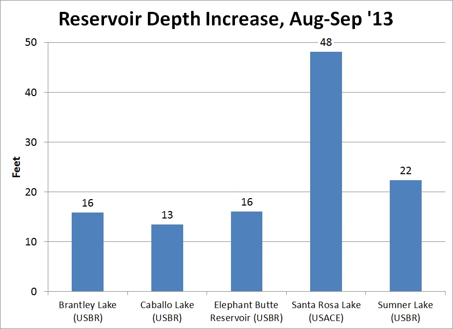
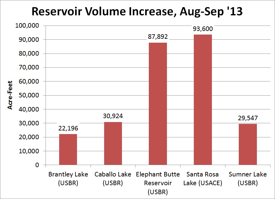
The summer of 2013 brought extreme weather to New Mexico. By mid-summer, New Mexico was in the driest two-year period on record, and 45% of the state was in exceptional drought. By the end of summer, however, New Mexico had experienced its 6th wettest monsoon season, resulting in widespread flooding around the state. How did the rain impact the many reservoirs around the state that had been severely depleted due to the drought? Below is the quick overview of the reservoir depth and volume increase after rainfall.
 |
 |
What’s wrong with the color in the images? These images were collected by the Landsat 8 satellite at the peak of the drought in August and again at the end of September. The Landsat satellite takes pictures in many bandwidths, some of which are invisible to the human eye. By layering the bandwidths in different combinations, certain natural and man-made features are easier to distinguish. In this case, Landsat Bands for red, near infrared, and shortwave infrared were combined to help us distinguish between land and water.


