Twitter YouTube
NM RGIS
 
Skip to content
  • About
  • Get Data
  • FAQ
  • GIS in Practice
  • Resources
  • Donate

Tag: Harvey House

Harvey Houses of New Mexico

  By sandeep January 15, 2015 January 30, 2015 GIS In Practice

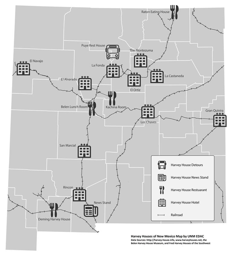
Fred Harvey began building hotels, restaurants, news stands, and sightseeing tours throughout the American Southwest in the late 1800’s. Use this map to learn more about Fred Harvey Properties located in New Mexico. Locations are provided with varying degrees of accuracy, and should not be used for navigation. Some locations… Continue reading

Tagged   Harvey House, Historic, New Mexico, RGIS
  • RGIS News

    • RGIS Funding
    • New Mexico Lidar Data Status Map
    • RGIS – New Data Portal
    • DEM Analysis – The many uses and derivatives of a Digital Elevation Model
    • Clandestine Meth Labs in New Mexico
    • Using Leaflet JS to map mines in and around New Mexico
    • Implementing Web AppBuilder for ArcGIS at the City of Rio Rancho
    • Updating Archeological Site Field Data Collection Methods to Twenty First Century
    • Up in Flames: Creating Defensible Spaces to Reduce Wildfire Damage
    • NM WRRI Acquires PRISM Climate Data
  • Tag Cloud

    3D Analyst 3D Elevation Program 3DEP Animas River Spill ArcGIS Blackdom Cadastral City of RioRancho data collection DEA DEM Drought Elevation ESRI Flood GAC geojson Ghost Town GIS Tips Groundwater Harvey House Historic Imagery JavaScript LeafletJS Lidar Meth Labs Mines Model Builder NAIP New Mexico PLSS QGIS Reservoir RGIS SNOTEL Snow cover Spatial Analyst Story Map Surface Analyst Township USGS Water Web AppBuilder Wildfire
  • Archives

  • Earth Data Analysis Center/RGIS Support Fund

  • Tweets by @nmrgis
All content Copyright © 2015 by the Earth Data Analysis Center, University of New Mexico
Phone: (505) 277-3622, Email: clearinghouse@edac.unm.edu
Powered by Parabola & WordPress.
Twitter YouTube