Twitter YouTube
NM RGIS
 
Skip to content
  • About
  • Get Data
  • FAQ
  • GIS in Practice
  • Resources
  • Donate

Tag: Imagery

2014 NAIP County Mosaics Now Available

  By sandeep January 19, 2015 January 30, 2015 GIS In Practice

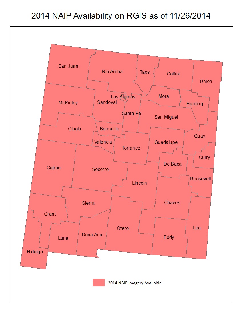
The statewide 2014 National Agricultural Imagery Program (NAIP) 1 meter aerial photography is now available for download. The imagery data are available as Mr. Sid compressed county mosaics (CCM). RGIS also serves polygons that delineate the seamline boundaries of the NAIP imagery that are used in creating these CCMs. To… Continue reading

Tagged   Imagery, NAIP, New Mexico
  • RGIS News

    • RGIS Funding
    • New Mexico Lidar Data Status Map
    • RGIS – New Data Portal
    • DEM Analysis – The many uses and derivatives of a Digital Elevation Model
    • Clandestine Meth Labs in New Mexico
    • Using Leaflet JS to map mines in and around New Mexico
    • Implementing Web AppBuilder for ArcGIS at the City of Rio Rancho
    • Updating Archeological Site Field Data Collection Methods to Twenty First Century
    • Up in Flames: Creating Defensible Spaces to Reduce Wildfire Damage
    • NM WRRI Acquires PRISM Climate Data
  • Tag Cloud

    3D Analyst 3D Elevation Program 3DEP Animas River Spill ArcGIS Blackdom Cadastral City of RioRancho data collection DEA DEM Drought Elevation ESRI Flood GAC geojson Ghost Town GIS Tips Groundwater Harvey House Historic Imagery JavaScript LeafletJS Lidar Meth Labs Mines Model Builder NAIP New Mexico PLSS QGIS Reservoir RGIS SNOTEL Snow cover Spatial Analyst Story Map Surface Analyst Township USGS Water Web AppBuilder Wildfire
  • Archives

  • Earth Data Analysis Center/RGIS Support Fund

  • Tweets by @nmrgis
All content Copyright © 2015 by the Earth Data Analysis Center, University of New Mexico
Phone: (505) 277-3622, Email: clearinghouse@edac.unm.edu
Powered by Parabola & WordPress.
Twitter YouTube